Screenshots From the README of serg-ill/air-threat-monitor.
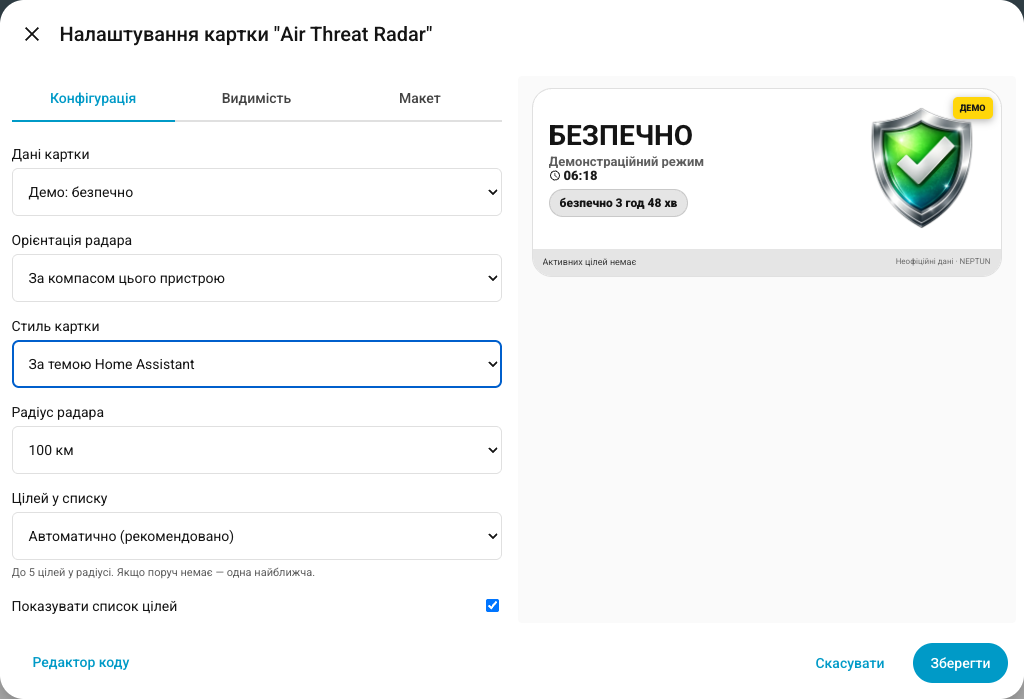
About
Air Threat Monitor is a Home Assistant integration that shows local air-alert status and nearby reported air threats. It adds a binary sensor for air alerts and sensors for the nearest threat and reported targets, with distance, bearing and heading calculated from a chosen location. Alert matching works by district and oblast, with separate yellow warning and red alert levels, and the data comes from NEPTUN through the vendor's cloud. A response-only action returns the full current target list for a configured location, which suits automations and scripts. The integration also provides a north-up radar card with a graphical editor, a demo mode and two visual styles. Location is set in the interface, with Home Assistant coordinates prefilled, and the project states it is informational only.
Automatic summary of the README and code of serg-ill/air-threat-monitor. Something wrong, or are you the maintainer and want your own text here? Get in touch
Supports
Uses the vendor's cloud Needs an internet connection and an account with the vendor.
From the Marketplace Installed through the Marketplace, formerly HACS.
Actively maintained Its author released or pushed a change in the last six months.
Provides
- Sensors
Setting it up
Install it from the Marketplace and restart Home Assistant, then add it under Settings, Devices and services.
Set up Air Threat Monitor
- Latitude
- Longitude
Also asked when changing the connection.
Texts from the code of serg-ill/air-threat-monitor.
Entities
- Binary sensorsAir alert
- SensorsNearest threat, Reported targets
Actions
- Get current targetsReturns the complete current target list calculated for one configured location.Fields: Location
Troubleshooting
- DiagnosticsDownloads a diagnostics file to attach to a bug report.
From the README
Air Threat Monitor is an independent Home Assistant custom integration that shows local air-alert status, nearby reported air threats, distances, movement direction, and a north-up radar card.
Informational use only. This project is not an official warning system and must never be the sole source of safety information. Always follow official air-alert signals and instructions from Ukrainian authorities.
- Setup entirely through the Home Assistant interface.
- Home Assistant coordinates are prefilled and can be changed before saving.
- Coordinates are processed locally and are not sent to the data provider.
- Local district/oblast air-alert matching with separate yellow warning and red alert levels from NEPTUN.
- Distance, bearing, heading, approach state, and target-category calculations.
- Standard north-up radar: north is at the top, east on the right, south at the bottom, and west on the left.
- Optional dynamic positioning from the device currently displaying the card, or from a selected Home Assistant person or device_tracker entity.
- Automatic district/oblast label resolved from the same coordinates used for dynamic threat calculations.
- Optional device-compass orientation while the card is open on a compatible phone.
- Bundled images for safe/alert states and supported target categories.
- Persisted start time and live duration for safe, yellow, and red periods.
- Compact total and per-category target analytics in the radar card.

Shows in Vulpo
Chart card, Apple Watch.Information
- Installs
- 74 sharing analytics
- GitHub stars
- 21
- Connection
- Uses the vendor's cloud
- Upkeep
- Updated in the last 6 months
- Version
- v0.5.1,
- Category
- Computers and network, Monitoring
- Kind
- Marketplace integration
- Needs
- Needs the Marketplace (HACS on 2026.10 and older)
- Domain
air_threat_monitor- Issues
- Report an issue